
|
|
#1
 04-25-2017, 12:00 AM
|
|||
|
|||
 Apple Maps **w Supports Transit in Paris
Apple Maps has been updated with Transit data for Paris, enabling iPhone users in the city and the greater ^Ile-de-France region to navigate with public transportation, including the subway, commuter trains, and buses.
 Apple Maps Supports many public transportation services operated by the RATP Group, including the Métro subway system, RER commuter trains, and buses. Transilien trains and select other services are also supported in the suburbs. Apple Maps is several years behind Google Maps in supporting Transit routing in Paris, as in many other cities, but Apple's public transportation support is comprehensive, mapping all station entrances and listing departure times. 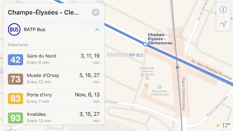 Apple Maps has had a Transit tab since iOS 9. At launch, the feature was limited to Baltimore, Berlin, Boston, Chicago, London, Los Angeles, Mexico City, New York, Philadelphia, San Francisco, Sydney, Toronto, and over 300 cities in China. Since then, Apple has been working to expand support for public transportation to other cities around the world. Newer additions include Atlanta, Columbus, Dallas, Denver, Detroit, Ho**lulu, Houston, Kansas City, Manchester, Melbourne, Miami, Minneapolis?Saint Paul, Montréal, New Orleans, Portland, Pittsburgh, Prague, Rio de Janeiro, Sacramento, Salt Lake City, San Antonio, San Diego, Seattle, and Vancouver, B.C. Apple Maps Transit support in Paris was expected, as station outlines in the city increased significantly in the weeks leading up to today's rollout. Likewise, Transit directions may soon be enabled in Adelaide and Perth in Australia, Las Vegas, Madrid, Phoenix, Rome, Singapore, Taiwan, and the Netherlands. A smaller number of station outlines in Apple Maps are visible in the American and Canadian cities of Albuquerque, Buffalo, Calgary, Edmonton, Orlando, Ottawa, Nashville, **rfolk, St. Louis, and Tucson. A complete list of cities that support Transit in Apple Maps is available on the iOS Feature Availability page of Apple's website. (Thanks, Bernd!) Tags: Apple Maps, transit, France Discuss this article in our forums أكثر... 
|
|
|


 العرض الشجري